



Electronic Conspicuity, or EC, has become a hot topic in the General Aviation industry in the last couple of years. The idea is that you make your aircraft electronically visible to other aircraft and ATC by using technology such as transponders, FLARM, SkyEcho or equivalent. Transponders are expensive, require an adequate power source not available on many aircraft and can require expensive maintenance. FLARM and SkyEcho address some of these issues but are not interoperable and still have some upfront costs. The UK CAA have a rebate scheme in place where pilots can receive 50% back up to £250 to encourage the use of EC devices. Unfortunately, a similar system has not been made available in Ireland.
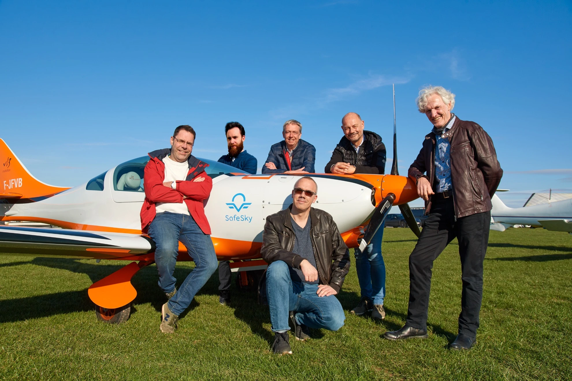
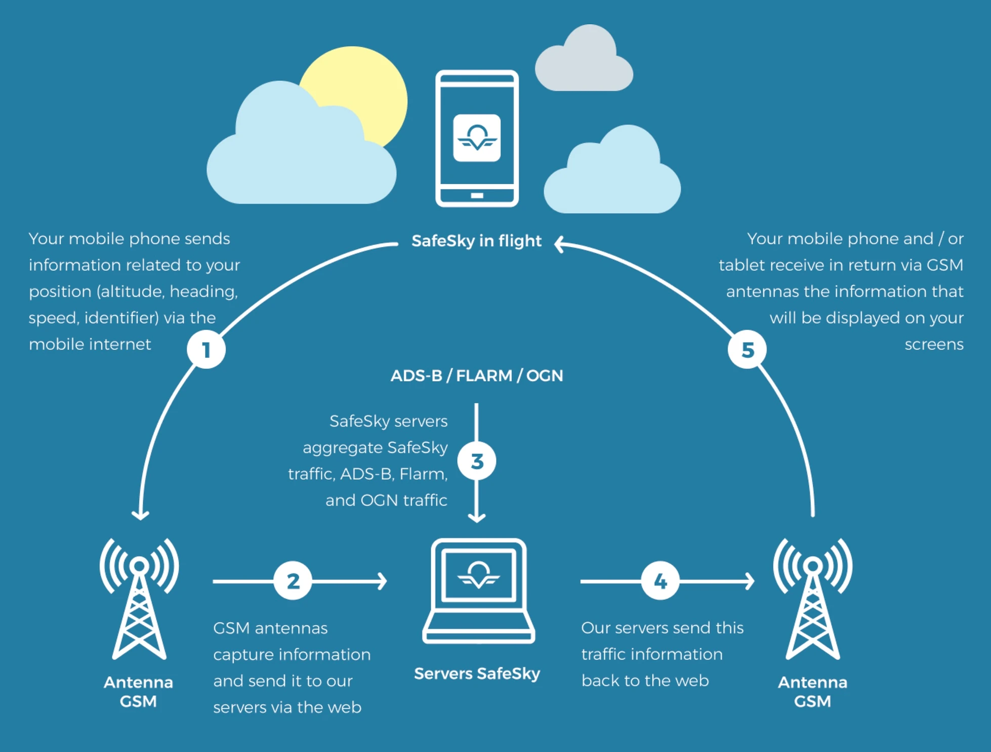
A group of six Belgian pilots got together in 2020 to address the EC problem and have developed an affordable solution called “SafeSky”. SafeSky is an App for IOS and Android that harnesses the technology in your mobile phone to send your position to the SafeSky servers, which is then transmitted in the same way, but in the opposite direction, to other users of the application. This way, you can share your location with the SafeSky community at any time.
The exchange protocol is extremely light and allows the transfer of the position even with a very weak mobile internet connection. An EDGE (2G) network is sufficient to exchange the few bytes necessary to share traffic positions in real-time.
In addition to the traffic generated by the application itself, SafeSky aggregates traffic information available on the internet, thanks to the numerous ground stations managed and maintained by many individuals. These stations allow SafeSky to obtain the position of aircraft transmitting ADS-B, Flarm or OGN signals with high accuracy. SafeSky collects this information and adds it to its own traffic to keep you informed. If you have SafeSky Premium, you will be able to use the GDL90 protocol and view this traffic in your navigation application such as SDVFR, SkyDemon, ForeFlight and EasyVFR. This effectively allows pilots access to a low-cost TCAS display which will give pilots awareness of surrounding traffic and reduce the threat of mid-air collisions.
Be Seen or Loose Access
U-Space, which is airspace used for drones and other Unmanned Aerial Vehicles, formally comes into force on 26th January. This will allow drone operators to request the designation of U-Space anywhere within Europe. To safely integrate drones and manned aircraft within U-Space, there needs to be a way for drones to ‘see’ manned aircraft. SafeSky has been working with EASA to ensure position data provided via the mobile network is acceptable. If you do not have a device capable of transmitting your position electronically, you may lose access to this airspace in future.
Anonymous Mode
Having spoken to a number of pilots around the country about this new app, there is still a sense of unease about having identifiable information transmitted. When pressed further, they say there is still some fear of ‘The Authority’ given some of their harsh enforcement actions in the past. To address this, SafeSky has an “Anonymous Mode” that will transmit your position to other airspace users but without any identifiable information.
Search & Rescue Feature
The App has an integrated Mayday feature that allows the pilot to inform their relatives of their position and, if necessary, to trigger Search & Rescue. This works as follows:
- The pilot chooses up to 3 close contacts. They recommend that some of them be pilots themselves in order to judge the urgency of the situation. SafeSky records their name, phone number and email address.
- Each of these contacts must read and accept the procedure sent to them.
- In the event of triggering the Mayday functionality, each of the contacts receives an SMS and/or an email indicating the route followed, the last known position and the telephone number of the competent services to contact, depending on the country where the alert was triggered (SafeSky is in contact with the authorities of 29 countries in Europe).
- It only remains for the contacts to forward the information received to the authorities. A personalised link to live.safesky.app containing the flight trace is also provided. The emergency can be cancelled at any time.
- SafeSky will also respond to requests from authorities to expedite the search.
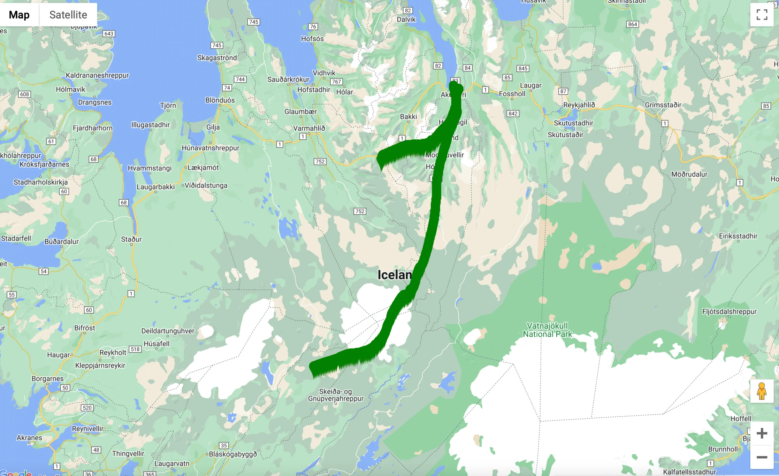
On that last point, in August two pilots encountered an engine failure while flying over Iceland. The pilot transmitted a Mayday but the SAR Services didn’t have a clear picture of the location and radio contact was lost. One of their friends who was waiting for their arrival immediately got in touch with the SafeSky team to check whether they could trace the flight and find the aircraft. There were quickly able to do this and informed Icelandic SAR to give them the last known position of the missing aircraft. The aircraft was found a short distance from the last transmitted location and both pilots were rescued.

Testing in Ireland

FunFly Aerosports Flying Club has just begun testing the SafeSky App in their Savannah S fleet based at Clonbullogue. All four aircraft are fitted with an iPad running SkyDemon so this is a perfect interface to display traffic around the aircraft. The basic SafeSky app is free to use but to take advantage of some of the integrations such as SkyDemon, you’ll need the Premium version which is €29.99 per year. To activate the traffic you must first start the SafeSky app, then start SkyDemon and select Fly. With SafeSky running in the background it will ask you if you want to Use Location Services or GDL90. By selecting GDL90, the position and traffic information will come from the SafeSky app. And that’s it, any traffic in the vicinity using a supported conspicuity device is visible on our SkyDemon screen. As always, technology doesn’t replace a good lookout but knowing where to look to identify traffic gives a considerable boost to flight safety.

One of our concerns was the ability to receive traffic information in areas with poor mobile signals. SafeSky completed research to measure internet reception up to 5000ft AGL. Globally there is 80.2% coverage although Ireland does fall quite a bit below this at 72.75%. Still, from our experience operating in the midlands at various altitudes, we are able to maintain a connection for traffic information.
Our verdict, we think it’s great! SafeSky is a cheap and affordable option to bring real-time traffic information into the cockpit to reduce the threat of mid-air collisions. Aggregating traffic information from several sources gives you visibility of the majority of aircraft fitted with electronic conspicuity devices. The basic app is free and can be used to make you visible when you’re flying from your smartphone or tablet. The more of us that use it, the better. More information from the SafeSky website www.safesky.app


