



As the 2026 flying season approaches, Irish pilots can once again rely on a familiar staple of VFR navigation with the release of the Rogers Data Ireland VFR ICAO Chart 2026. Widely regarded as the standard VFR chart for flying in Irish airspace, the latest edition builds on an already proven product, introducing several refinements shaped directly by pilot feedback. The Ireland VFR ICAO Chart 2026 is available exclusively in Ireland through Pilot.ie, ensuring local availability for general aviation pilots, flying clubs, and training organisations as preparations begin for the new season.
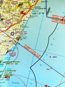
A defining feature of Rogers Data charting is its commitment to continuous improvement. The 2026 VFR ICAO Charts are the result of extensive feedback from pilots, flight instructors, aeroclubs, and aviation specialists, with practical experience playing a central role in shaping each update. Rather than making disruptive changes, the focus for 2026 has been on refining clarity, legibility, and situational awareness — the qualities pilots depend on most in real‑world flying conditions.
Key Updates in the 2026 Edition
Optimised Forest Representation: Forest areas are key visual reference points during VFR navigation, helping pilots orient themselves to terrain and surrounding features. In the 2026 edition, forest depiction has been refined to improve clarity and consistency, making wooded areas easier to recognise without overcrowding the chart.
Updated Topography for 2026: The chart now incorporates a new topographic database, reflecting the latest available geospatial data. Terrain features, settlements, and infrastructure have been updated to ensure the chart accurately represents today’s landscape, supporting more precise planning and navigation.
Improved Visibility of Railway Lines: Railway lines have been enhanced to improve visibility, making them more effective as linear navigation aids. This update is particularly useful when navigating along transport corridors or using rails as secondary reference features during cross‑country flights.
Road Numbers Clearly Labelled: Major road numbers in Ireland and the UK are now clearly shown on the chart. This allows for quicker visual identification of primary road routes, improving cross‑referencing between chart features and the ground — especially valuable during training flights and navigation exercises.
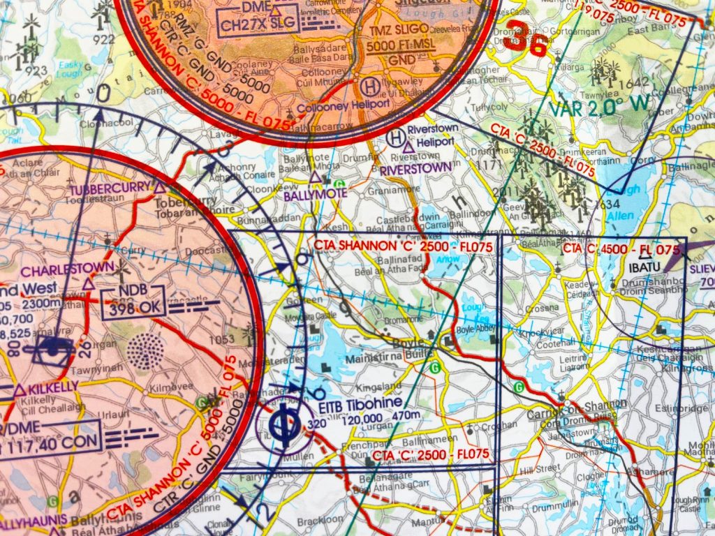
Alongside these updates, the core qualities pilots expect from Rogers Data charts remain unchanged:
- ICAO‑compliant design, produced to international standards and well-suited to both training and operational use
- Scale of 1:500,000, offering an ideal balance between detail and coverage for VFR navigation
- Clear representation of airspace structure, including controlled airspace, restricted and danger areas, and reporting points
- Includes recent airspace changes around Knock / Ireland West Airport
- Laminated paper construction, allowing pilots to write, wipe, and reuse the chart cleanly and residue‑free
- Seamless chart continuity across Europe and beyond, supporting consistent cross‑border flight planning
For Irish pilots, the Ireland VFR ICAO Chart 2026 is available exclusively via Pilot.ie, Ireland’s dedicated pilot and aviation supplies retailer. This exclusivity ensures easy local access to current charts and supports timely distribution ahead of peak flying activity. The Rogers Data Ireland VFR ICAO Chart has long been a trusted companion in Irish cockpits. With its thoughtful updates for 2026, guided by practical experience and pilot input, it continues to stand as an essential tool for safe, informed VFR flying in Irish airspace.
Click here for more details.

