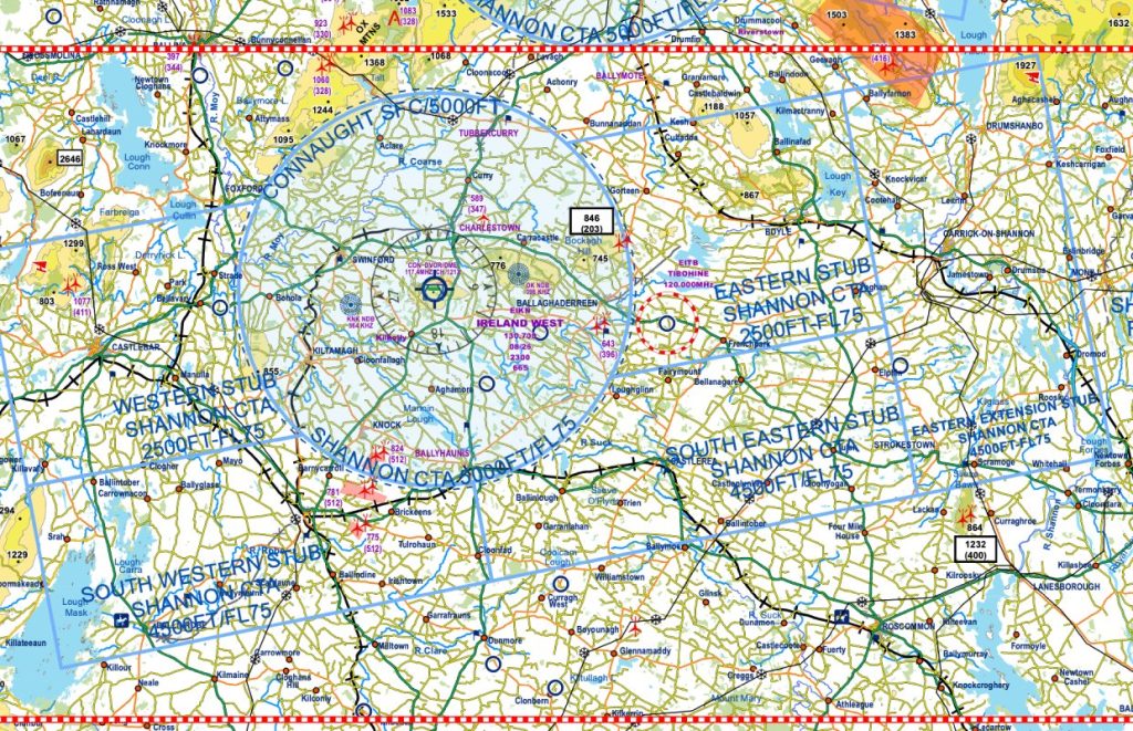



Admittedly these changes were circulated by the IAA last August but from reviewing the chart at the time, there were no obvious changes to the airspace that warranted publication. However, at the VFR Charting Workshop that took place last week it became clear that there have in fact been changes to the Ireland West CTA, details of which can be found below. A proper public consultation by the relevant ANSP would have avoided any ambiguity. ENR6.1 in the AIP does not reflect the latest airspace changes so beware!
There’s no text description of the changes but effectively the Ireland West Airport CTA has been extended by 2NM to the east and west. The changes apply to both the 2,500ft and 4,500ft stubs. These are particularly significant on the eastern edge as it was ‘normal’ procedure for traffic routing towards Sligo to remain east of Lough Key and Lough Arrow to remain clear of the 2,500ft stub. Pilots should now route further east again to remain clear of controlled airspace if operating above 2,500ft and below 4,500ft. The new changes are reflected on SkyDemon but will need to be amended by hand on the existing IAA and Rogers Data VFR Charts. The full PDF chart can be downloaded here.